Drive Anna Maria Island From End to End: What Prospective Homebuyers Should See
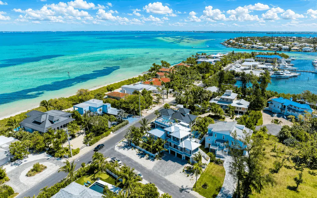
One of the best ways to understand Anna Maria Island real estate is to drive the island from end to end before narrowing your property search. Starting around Coquina Beach in Bradenton Beach and continuing north through Holmes Beach to the City of Anna Maria reveals how much the island changes within roughly seven miles. Buyers can compare beach access, bay and canal settings, commercial districts, residential streets, condominium areas, mainland connections and everyday conveniences in a single trip. The goal is not simply sightseeing, it is learning which part of the island works with the way you expect to own and use a property.
The drive is especially useful because Anna Maria Island is divided among three separate municipalities. Bradenton Beach occupies the southern portion, Holmes Beach is in the center and the City of Anna Maria is at the northern end. Those boundaries affect more than atmosphere. They can also affect municipal procedures, vacation-rental requirements, permitting and other property-specific considerations. Hunt Brothers Realty's Anna Maria Island real estate buyer's guide provides the broader due-diligence framework to use alongside this driving tour.
Quick Answers About Driving Anna Maria Island as a Homebuyer
How Long Is Anna Maria Island?
The Anna Maria Island Chamber of Commerce describes the island as approximately seven miles long. Its three municipalities are Bradenton Beach on the south, Holmes Beach in the center and the City of Anna Maria on the north.
Where Should a Homebuyer Start an Island Driving Tour?
Starting at Coquina Beach on the southern end creates a logical south-to-north tour. From there, buyers can move through Bradenton Beach and Bridge Street, continue through Holmes Beach and Manatee Public Beach, then explore Pine Avenue and residential streets in the City of Anna Maria.
Can You Drive the Whole Island Without Leaving Gulf Drive?
Gulf Drive provides the primary north-south spine through much of Anna Maria Island, but prospective buyers should deliberately leave the main road. Residential side streets, canals, bayfront areas, beach access routes and commercial districts often reveal more about daily ownership than the main drive alone.
What Should Buyers Pay Attention to During the Drive?
Watch how each property relates to the beach, bay, canals, shopping, restaurants, parking, trolley stops and mainland access. Also notice elevation differences, construction styles, neighboring property uses, traffic patterns and whether a home's advertised beach or boating access feels practical when experienced in person.
Should Buyers Drive the Island More Than Once?
When practical, yes. Traffic, parking, pedestrian activity and the atmosphere of individual streets can change by time of day, weekday versus weekend and visitor season. A second trip can provide a different view of the same location.
Can You Explore Anna Maria Island Without Driving?
Yes. The Anna Maria Island Chamber states that the free island trolley connects Coquina Beach on the southern end with the City Pier area in Anna Maria on the northern end, with stops throughout the island. For a homebuyer, combining a driving tour with walking or trolley trips can reveal how practical a location feels without relying on a car for every outing.
Why Does the Municipality Matter When Touring Homes?
Bradenton Beach, Holmes Beach and Anna Maria are separate cities. Buyers should identify the municipality of every property because municipal rules, vacation-rental procedures, permitting and other requirements can differ even when two homes are only a few miles apart.
Why Drive Anna Maria Island Before Choosing a Neighborhood?
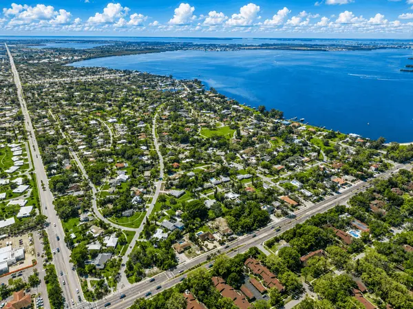
Online listings are excellent for comparing bedrooms, square footage, pools and photographs, but they can flatten the geography of a barrier island. A map may show two properties only a short distance apart while concealing substantial differences in beach access, traffic, waterfront orientation, nearby commercial activity and the route to the mainland.
Driving the island puts those differences into context. You can see how Bradenton Beach relates to the Cortez Road bridge, how Holmes Beach functions as the central part of the island and how the northern streets of Anna Maria differ from areas around Pine Avenue.
The exercise can also refine your property search. A buyer who initially thinks direct Gulf frontage is essential may discover that walking a short distance to the beach from a canal home better matches boating priorities. Another buyer may realize that being near shops and restaurants matters more than being at the northern tip of the island.
Stop 1: Start at Coquina Beach on the Southern End
Coquina Beach provides a useful starting point because it places you at the southern end of Anna Maria Island in Bradenton Beach. Before looking at houses, spend a few minutes understanding the geography. The Gulf of Mexico is on one side of the narrow island environment, while bay and Intracoastal waters shape the opposite side.
For buyers, this southern location demonstrates an important Anna Maria Island principle: being close to the beach does not always require owning direct Gulf frontage. In portions of Bradenton Beach, the island is narrow enough that Gulf and bay environments can both influence the lifestyle of a property.
As you begin driving north, notice the mixture of beach access, low-rise properties and waterfront settings. Ask yourself whether your priority is immediate sand access, a water view, boating, a condominium with shared amenities or a detached home with more private outdoor space.
Homebuyer Checkpoint at Coquina Beach
- How important is immediate Gulf access?
- Would you use a public beach frequently enough to prioritize walking distance?
- Do you prefer a condominium or detached coastal home?
- How much parking do you realistically need?
- Would proximity to the southern end of the island fit your mainland travel patterns?
Stop 2: Explore Bradenton Beach Beyond the Sand
Continue north into Bradenton Beach, the southernmost of Anna Maria Island's three municipalities. The real estate here includes detached homes, smaller condominium communities, Gulf-front properties, bay-oriented residences and vacation-oriented properties.
This is a particularly useful part of the drive for understanding how dramatically a property can change within a few blocks. Some communities sit directly on the Gulf. Others occupy the bay side while maintaining convenient access to the beach. Hunt Brothers Realty's guide to Old Bridge Village, for example, illustrates how a Bradenton Beach condominium can combine bay-side boating with Gulf access nearby.
Farther north, Runaway Bay demonstrates another version of beach-to-bay living, with the community extending through the narrow island environment between Gulf Drive and bay waters.
Stop 3: Turn Toward Historic Bridge Street
Bridge Street is worth leaving Gulf Drive to explore. The Anna Maria Island Chamber identifies Bridge Street as one of the island's distinctive shopping areas, and its history is closely connected with the original bridge between the island and Cortez.
For prospective buyers, Bridge Street provides a useful lesson in micro-location. A property close to restaurants, shops and waterfront activity can offer a very different experience from a residence several blocks away on a quieter street.
Park when practical and walk several blocks. Look at the route to the beach, the bay, restaurants and island transportation. If you are considering a vacation property, notice parking demand and surrounding activity, but do not infer rental eligibility from the neighborhood. Bradenton Beach has its own municipal requirements, and condominium or deed restrictions may impose additional rules.
Homebuyer Checkpoint Around Bridge Street
- Do you want restaurants and shops within a short walk?
- How do you feel about visitor activity near your property?
- Is bay access or boating as important as Gulf access?
- Does the available parking fit your intended use?
- How important is relatively direct access toward Cortez and mainland Bradenton?
Stop 4: Notice the Cortez Road Connection to the Mainland
As you tour Bradenton Beach, pay attention to the Cortez Road connection between the island and mainland. For buyers who expect to leave the island regularly for work, appointments, shopping, airport trips or other mainland destinations, bridge access can be an important part of daily life.
Do not evaluate this only by mileage. Island traffic can vary with season, time of day, weather, beach demand and events. When mainland access matters to your purchase, drive the route under conditions similar to when you expect to use it.
Across the bridge, historic Cortez is a working waterfront community that also helps explain the maritime character of this part of Manatee County. The Anna Maria Island Chamber describes Cortez as one of Florida's longstanding working fishing communities.
Stop 5: Cross Into Holmes Beach and Watch the Island Change
Continue north and you enter Holmes Beach, the central municipality on Anna Maria Island. This is where many buyers begin to see a different balance between residential neighborhoods and everyday island conveniences.
Holmes Beach contains detached homes, condominiums, Gulf-oriented properties, canal homes and established residential streets. It also contains a significant share of the island's everyday businesses and services.
For buyers comparing island locations, the central position can be significant. You are between Bradenton Beach to the south and Anna Maria to the north, with another major mainland connection available along Manatee Avenue.
Stop 6: Get Out at Manatee Public Beach
Manatee County Public Beach is an important geographic reference point for prospective Holmes Beach buyers. The Chamber's current island map identifies it as a major stop along the island's north-south transportation route, near the Manatee Avenue connection to the mainland.
From a real estate perspective, this is a good place to understand the relationship between beach access and the central island road network. Homes and condominiums can be direct Gulf-front, across Gulf Drive, within a short walk or farther into residential neighborhoods.
A listing that says "steps to the beach" should never substitute for walking the actual route. Check the street crossing, public access point, distance, parking environment and how carrying chairs or beach equipment would affect the trip.
Stop 7: Compare Holmes Beach Condo Locations
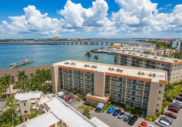
Holmes Beach is particularly useful for buyers comparing condominium lifestyles because the location alone does not tell you what the ownership experience will be. Hunt Brothers Realty's Holmes Beach communities include direct beachfront properties, near-beach communities, bay-side condos and townhome-style residences.
Island Beach Club illustrates a small direct Gulf-front condominium setting. North Beach Village provides a townhome-style condominium environment near the Gulf rather than directly on it.
Drive past several different condo locations before deciding what "island condo" means to you. Direct Gulf frontage, a short beach walk, bay access, a pool, garage parking and boating features each create different purchase considerations.
What Condo Buyers Should Notice From the Street
- Building elevation and parking configuration
- Distance and route to the Gulf
- Whether the property is Gulf-front, bay-side or interior
- Exposure to Gulf Drive traffic
- Guest parking and vehicle access
- Proximity to restaurants, shopping and trolley stops
Street observations are only a starting point. Association budgets, reserves, insurance, assessments, structural information, maintenance responsibilities, rental rules, pets, parking rights and unit condition require document review and property-specific verification.
Stop 8: Explore the Canal Side of Holmes Beach
Do not spend the entire Holmes Beach portion of your tour on Gulf Drive. Turn into residential streets and explore areas where canals and bay waters become more prominent. This reveals a different version of island ownership from a direct beachfront property.
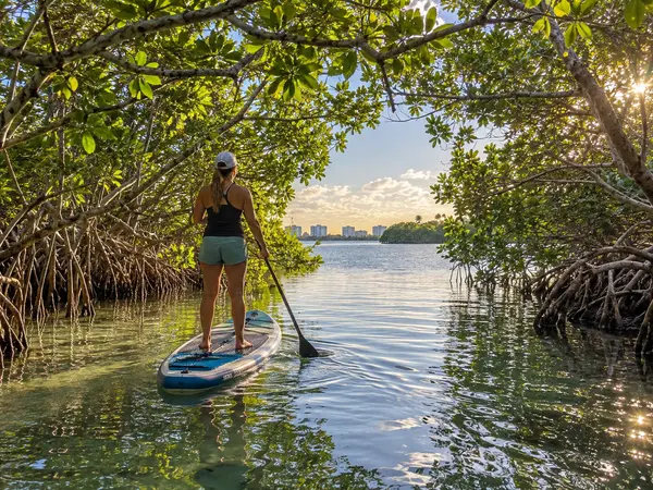
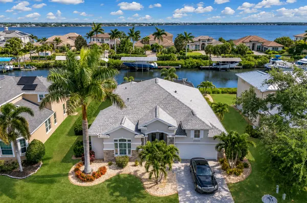
A canal home may place a boat behind the house while keeping the Gulf within walking, biking or driving distance. That combination can be attractive, but "waterfront" alone does not establish useful boating access.
Buyers considering canal or bay properties should investigate dock and lift permits, seawall condition, water depth, tides, bridge clearances, canal width, navigation routes and maintenance responsibilities. Hunt Brothers Realty's Anna Maria Island buyer's guide explains why waterfront due diligence needs to go well beyond the view.
Stop 9: Notice Holmes Beach's Everyday Conveniences
As you continue through Holmes Beach, notice how many routine island needs are concentrated in the central portion of Anna Maria Island. The Anna Maria Island Chamber identifies several shopping areas in Holmes Beach, while its offices are also located along Gulf Drive in the city.
This matters more for a full-time or extended-stay owner than it may appear during a vacation. Think about groceries, hardware, restaurants, personal services and how often you expect to travel to the mainland.
A buyer deciding between the center and north end of the island can also review Hunt Brothers Realty's Holmes Beach versus Anna Maria lifestyle comparison for a closer look at those differences.
Stop 10: Cross Into the City of Anna Maria
Continue north and you enter the City of Anna Maria. This is the northernmost of the island's three municipalities and presents another change in the residential environment.
The city's own map shows a network of residential streets stretching between Gulf and bay waters, with Pine Avenue running across the city toward the City Pier area. Beach accesses, parks, bike routes and waterfront destinations are distributed throughout the northern section.
Slow down here and leave the main route. The northern part of the island is better understood from its side streets than from a single drive through town.
Stop 11: Drive Pine Avenue From Gulf to Bay
Pine Avenue is one of the most useful streets for understanding the City of Anna Maria. It runs across the island and connects the residential environment with shops, restaurants, civic destinations and the bay side.
The Anna Maria Island Chamber specifically identifies Pine Avenue as one of the island's distinctive shopping areas. For buyers, the street demonstrates how a home can be in a predominantly residential municipality while still being near a compact commercial district.
If a listing emphasizes walkability to Pine Avenue, park near the property and test the route. Determine whether the distance, sidewalks, street crossings, heat and weather exposure work for your own routine rather than relying on a map measurement.
Homebuyer Checkpoint Around Pine Avenue
- Would you regularly walk or bike to shops and restaurants?
- Do you prefer being close to Pine Avenue or farther into residential streets?
- Which beach access would you actually use?
- How important is proximity to bayfront destinations?
- Does the home's location work for your trips off the island?
Stop 12: See the City Pier and Bay Side
The eastern end of Pine Avenue and the City Pier area help buyers understand the Tampa Bay side of Anna Maria. Even if your search is focused on Gulf beaches, the bay side is worth seeing because it demonstrates how different waterfront environments coexist within a very small geographic area.
The City of Anna Maria's current map identifies the City Pier, City Pier Park, Bayfront Park and multiple bay-side roads and public spaces. Conditions and access at individual facilities can change following storms, repairs or municipal projects, so buyers should verify current conditions rather than assuming every mapped feature is operating normally.
For a homebuyer, the larger point is to compare Gulf-oriented living with bay-oriented living. Sunsets, boating routes, beach access, wind exposure and views can differ depending on which side of the island a property occupies.
Stop 13: Continue Toward the Northern End and Bean Point Area
Continue through the northern residential streets and the island becomes increasingly defined by its shoreline. The City of Anna Maria's official map identifies Bean Point at the northern tip, along with multiple beach access points and North Shore Drive.
This part of the tour is particularly useful for buyers attracted to the idea of a northern-island home. Drive slowly through the surrounding streets, then park legally and walk the routes that matter to you. A property can feel very different once you understand the actual distance to the Gulf, bay, Pine Avenue and the route south toward the mainland bridges.
Beach and shoreline conditions can change over time due to storms, erosion, restoration projects and access work. Verify current public access and conditions directly rather than relying on an older property listing or tourism description.
What Should Buyers Notice About the Homes Themselves?
An end-to-end island drive also reveals how varied the housing stock is. Buyers may see older cottages, renovated homes, elevated coastal construction, luxury residences, small condominium buildings, townhome-style condos and waterfront homes with docks.
Do not assume newer is automatically better or older is automatically problematic. The condition, renovation history, elevation, permits, roof, windows, doors, electrical system, plumbing, HVAC equipment, drainage and storm-related history need to be evaluated for the specific property.
Inspection findings should be reviewed with the appropriate licensed home inspector, contractor, engineer or other qualified professional before a buyer makes a decision based on a property's condition.
Look at Elevation, Not Just the View
While driving, you will notice substantial differences in how island homes relate to ground level. Some older properties sit relatively low, while many newer coastal homes place living areas above garages, storage or other lower-level spaces.
What you see from the road is not enough to establish a property's flood risk, legal elevation or insurability. Buyers should obtain current flood-zone information, available elevation documentation and property-specific insurance quotes.
Flood insurance requirements and insurance availability depend on the property, financing, construction characteristics and other factors. Buyers should review insurance questions with a qualified insurance professional and flood or elevation information with the appropriate surveyor, lender, local authority or other qualified professional.
Look Closely at Beach Access
Beach access is one of the easiest property features to overestimate from an online listing. "Near the beach" can describe very different experiences depending on the block, crossing and public access point.
When a property interests you, walk from its front door to the beach access you expect to use. Consider whether you would make that trip carrying chairs, umbrellas, a cooler or other beach equipment. Notice road crossings, sidewalks, shade and the route home.
Buyers specifically seeking direct frontage can compare current Anna Maria Island beachfront homes for sale and Anna Maria Island beachfront condos.
Look at the Water Differently if You Own a Boat
A waterfront view and useful boating access are not the same thing. As you drive canals and bay-side streets, pay attention to canal width, docks, lifts, bridges and the route toward navigable water.
If a particular waterfront home becomes a serious candidate, verify:
- Legal waterfront and dock rights
- Dock and boat-lift permits
- Lift capacity
- Seawall age and condition
- Water depth at relevant tides
- Canal width
- Bridge clearances
- Navigation route to open water
- Survey boundaries and easements
- Maintenance and future replacement obligations
Marine infrastructure should be evaluated with the appropriate surveyor, marine contractor, engineer, permitting authority, attorney or other qualified professional before a purchasing decision depends on a particular boating feature.
Test the Trolley as Part of Your Homebuyer Tour
The free Anna Maria Island trolley is useful for more than visitors. The Anna Maria Island Chamber states that the trolley loops between Coquina Beach on the southern end and the City Pier area in Anna Maria on the north, with numerous stops in both directions.
Current Chamber information says service begins at 6 a.m. from both ends of the route, with frequent service through the day and evening, although traffic, weather and operating conditions can affect actual service. Buyers should verify the current schedule and nearest stop rather than assuming historical service details will remain unchanged.
If reducing car use is part of your island plan, ride the trolley from near a prospective property to places you expect to visit. A location that works well by trolley, bike and on foot can feel very different from one where nearly every outing requires driving.
Drive Both Mainland Connections if They Matter to You
A prospective buyer should think beyond the island itself. Bradenton Beach connects toward mainland Cortez, while Holmes Beach provides another principal route toward West Bradenton via Manatee Avenue.
Which connection feels more convenient depends on where you buy and where you expect to travel. Someone making frequent trips to mainland Bradenton may evaluate island geography differently from an owner who plans to spend most days on the island.
Travel times can vary substantially with traffic, bridge openings, visitor demand, construction, weather and season. Test the routes rather than relying on a fixed drive-time estimate.
Drive the Island at More Than One Time of Day
A morning home tour tells you only part of the story. When practical, return during another period before making a major purchasing decision.
Observe how the streets function around beach hours, dinner time and weekends. Notice parking demand, pedestrian activity and how easily you can enter or leave the neighborhood. These are observations about the practical use of a location, not substitutes for official traffic, zoning or municipal information.
For a vacation-oriented property, this exercise can also show how the surrounding block functions when visitors are active. For a primary residence, it can help you decide whether the location fits your normal routine.
Do Not Assume Rental Rules Are the Same Across the Island
The island may feel continuous as you drive north, but its municipal framework is not. Bradenton Beach, Holmes Beach and Anna Maria have separate governments, and vacation-rental requirements must be investigated according to the exact property.
Private restrictions matter too. A condominium association, homeowners association, deed restriction or other governing document may impose limitations beyond municipal requirements.
If rental use is important to the purchase, verify current zoning, registration and licensing requirements, minimum stays when applicable, occupancy, parking, association restrictions, insurance and tax considerations before relying on projected rental use or income. Legal and tax questions should be reviewed with qualified Florida legal and tax professionals.
What Should You Write Down During the Drive?
By the end of a full island tour, neighborhoods can begin to blur together. A simple set of notes can make the trip much more useful when you later compare listings.
- Municipality: Bradenton Beach, Holmes Beach or Anna Maria
- Water relationship: Gulf-front, near beach, bayfront, canal, water view or interior
- Beach route: direct access, street crossing or longer walk
- Boating: dock, lift, canal or bay access if applicable
- Commercial access: distance to restaurants, groceries and shopping
- Transportation: trolley stop, bike route and mainland access
- Parking: private, garage, assigned, guest or street considerations
- Housing style: cottage, elevated home, condo, townhome or luxury residence
- Street setting: main road, commercial area, residential side street, beach block or canal
- Questions to verify: insurance, flood, rentals, permits, association rules and waterfront infrastructure
What Should You Never Decide From a Driving Tour Alone?
A driving tour is excellent for understanding location, but it cannot answer many of the questions that determine whether an island property is a sound fit for your intended use.
Do not make assumptions from appearance alone about:
- Flood-zone designation or elevation
- Homeowners or flood insurance premiums
- Vacation-rental eligibility
- Legal parking rights
- Permitted bedrooms or improvements
- Property boundaries
- Dock or beach rights
- Seawall condition
- Association financial condition
- Building or home condition
- Future development or regulatory changes
These issues require current documents and property-specific research. Buyers should use the appropriate licensed real estate professional, insurance professional, lender, home inspector, contractor, structural engineer, surveyor, title professional, Florida real estate attorney, tax professional, association or local government authority when individualized verification is needed.
Additional Questions About Touring Anna Maria Island
What Are the Three Cities on Anna Maria Island?
From south to north, they are Bradenton Beach, Holmes Beach and the City of Anna Maria. They are separate municipalities on the same barrier island.
Does the Trolley Travel the Length of Anna Maria Island?
Yes. Current Anna Maria Island Chamber information describes the free trolley as looping from Coquina Beach in Bradenton Beach to the City Pier area in Anna Maria, with stops throughout the island. Current operating information should be checked before relying on the service.
Where Is Bridge Street?
Bridge Street is in Bradenton Beach on the southern part of Anna Maria Island. It is one of the island's established shopping, dining and waterfront districts.
Where Is Manatee Public Beach?
Manatee County Public Beach is in Holmes Beach near the Manatee Avenue approach to the island. It is a useful central landmark for buyers exploring Holmes Beach real estate.
Where Is Pine Avenue?
Pine Avenue is in the City of Anna Maria on the northern end of the island. It connects Gulf-side areas with shops, restaurants and the City Pier area toward Tampa Bay.
Should You Tour Anna Maria Island Before Scheduling Showings?
A preliminary island tour can make property showings more efficient because it helps identify which municipalities, waterfront types and street settings match your priorities. A second tour focused on specific properties can then test beach routes, mainland access and nearby destinations in greater detail.
The Best Island Tour Ends With a Shorter Property List
Driving Anna Maria Island from Coquina Beach to the northern end is not about choosing the prettiest stop. It is about learning how the island works as a place to own property.
Bradenton Beach demonstrates the close relationship among Gulf beaches, bay waters, Bridge Street and the southern mainland connection. Holmes Beach shows the island's central residential and commercial mix, with condominiums, canals, beaches and everyday conveniences. Anna Maria introduces the northern residential setting, Pine Avenue, bayfront destinations and distinctive northern shoreline.
Once you have driven all three, your search can become more property-specific. Instead of simply looking for "a house on Anna Maria Island," you can decide whether you want a Gulf-front condo in Holmes Beach, a Bradenton Beach property near both Gulf and bay, a canal home with verified boating access or a residence near Pine Avenue in Anna Maria.
Explore Anna Maria Island Real Estate
If an end-to-end island tour helps clarify where you want to focus, Hunt Brothers Realty can help you compare properties across all three Anna Maria Island municipalities. Start with the Anna Maria Island buyer's guide, explore Holmes Beach real estate, review City of Anna Maria real estate, compare Anna Maria Island beachfront homes, or contact Hunt Brothers Realty to plan a property search around the island locations that fit your priorities.
This article is provided for general informational and educational purposes only. Road conditions, public access, trolley service, municipal requirements, vacation-rental rules, flood information, insurance, permitting, association restrictions, parking, property condition and waterfront rights can change or vary by property. Buyers should verify current information for the specific address and consult the appropriate licensed real estate professional, lender, insurance professional, home inspector, contractor, structural engineer, surveyor, title professional, qualified Florida real estate attorney, tax professional, association or local government authority when a purchasing decision requires individualized guidance.
Sources
- Anna Maria Island Chamber of Commerce, Anna Maria Island Overview
- Anna Maria Island Chamber of Commerce, Official Visitors Guide and Island Map
- Anna Maria Island Chamber of Commerce, Island Trolley
- Anna Maria Island Chamber of Commerce, Island Shopping Districts
- City of Anna Maria, Map and Guide
- Hunt Brothers Realty, Anna Maria Island Real Estate Buyer's Guide
- Hunt Brothers Realty, Anna Maria Island Real Estate
- Hunt Brothers Realty, Holmes Beach Real Estate
- Hunt Brothers Realty, City of Anna Maria Real Estate
Contact Hunt Brothers Realty
46 N. Washington Blvd, Ste 3, Sarasota, FL 34236
Phone: (941) 388-7017
Email: info@huntbrothersrealty.com
Website: HuntBrothersRealty.com
Categories
- All Blogs 1606
- Anna Maria Island 77
- Bird Key 3
- Bradenton 144
- Buying a Home 741
- Casey Key 2
- Clearwater 5
- Condos & HOA Living 648
- Ellenton 4
- Englewood 5
- First Time Homebuyers 821
- Foreclosures 3
- Homeownership 809
- Lakewood Ranch 15
- Lido Key 25
- Longboat Key 72
- Luxury/Waterfront Properties 746
- Market Updates & Trends 397
- Mortgages & Financing 34
- Move-Up Buyers 20
- Neighborhood Guides 546
- New Construction 27
- Palmetto 2
- Parrish 4
- Port Charlotte 7
- Punta Gorda 11
- Real Estate Investing 679
- Relocation to Florida 729
- Safety Harbor 2
- Sarasota 16
- Sarasota - Downtown 140
- Selling a Home 138
- Siesta Key 87
- St. Petersburg 3
- Tierra Verde 4
- Vacation & Second Homes 860
- Venice 21
- Wellen Park 7
Recent Posts