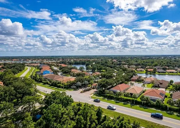
Sarasota Sandbars, Passes and Bays: A Beginner’s Guide for Future Gulf Coast Residents
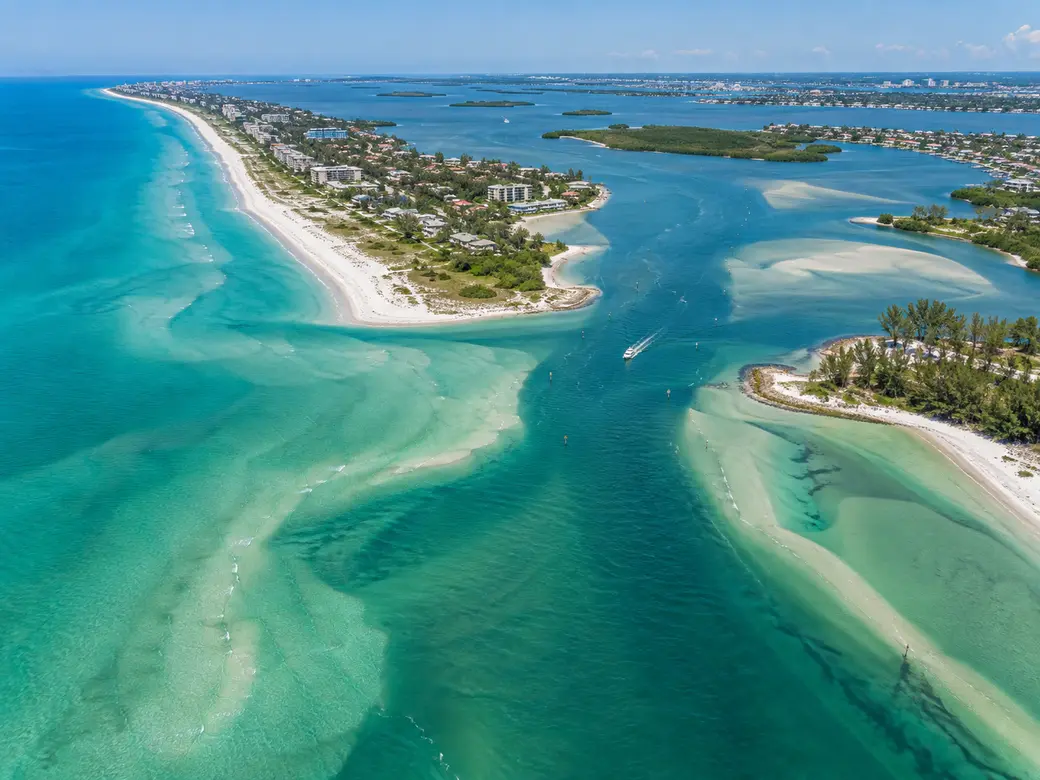
Understanding Sarasota’s water starts with a few basic distinctions. Sarasota Bay and Little Sarasota Bay are protected coastal waters behind the barrier islands. Big Sarasota Pass, New Pass and the currently open Midnight Pass connect bay waters with the Gulf of Mexico. Sandbars are shallow accumulations of sediment that can change with tides, currents and storms, while marked channels provide established routes through portions of these waters. For future Gulf Coast residents, this geography matters well beyond recreation. It can influence boating routes, dock usability, waterfront-property research and even which part of Sarasota feels most compatible with the way you expect to use the water.
Quick Answers About Sarasota Sandbars, Passes and Bays
What is Sarasota Bay?
Sarasota Bay is an estuarine system protected from the open Gulf by barrier islands including Longboat Key and Lido Key. It contains channels, shallow flats, seagrass habitat, islands and waterfront communities, making it central to boating and coastal living in the Sarasota area.
What is a pass?
A coastal pass or inlet is an opening connecting the Gulf with protected bay waters. Sarasota-area examples include New Pass, Big Sarasota Pass and the currently open Midnight Pass. These are dynamic environments where tides, currents, depths and shoaling require attention.
Where is Big Sarasota Pass?
Big Sarasota Pass separates Lido Key from Siesta Key and connects Sarasota Bay with the Gulf of Mexico. It is one of the defining geographic features around the southern end of Lido Key and northern Siesta Key.
Where is New Pass?
New Pass lies between Lido Key and Longboat Key and provides another connection between Sarasota Bay and the Gulf. Waterfront buyers should distinguish geographic access to a pass from vessel-specific navigability from an individual property.
Is Midnight Pass open?
Yes, as of September 2026. Sarasota County reports that Hurricane Helene reopened an inlet in September 2024 and Hurricane Milton fully reopened Midnight Pass in October 2024. The County continues to survey and monitor the inlet.
Are Sarasota sandbars permanent?
Do not assume so. Sand and shoals can shift as currents, tides, storms and other coastal processes move sediment. A location that appeared navigable or exposed during a previous visit should not be treated as a permanent condition.
Why should a homebuyer understand Sarasota’s waterways?
Because two waterfront homes can provide completely different boating experiences. Water depth, tides, bridges, channels, docks, lifts and the route from a property to Sarasota Bay or the Gulf all matter. Hunt Brothers Realty’s guide to deep-water access in Sarasota explains why these details require property-specific verification.
Start With Sarasota’s Barrier-Island Geography
The easiest way to understand Sarasota’s coastal waters is to picture the Gulf first. Offshore from much of mainland Sarasota is a chain of barrier islands. Longboat Key, Lido Key and Siesta Key help separate the open Gulf from the protected bay waters behind them.
Between those islands are openings that allow water to move between the Gulf and the bays. These are the passes. Behind the islands are Sarasota Bay and, farther south, Little Sarasota Bay, along with smaller waterways, canals and connected coastal environments.
Once you understand that basic arrangement, many Sarasota real estate descriptions become easier to interpret. A home described as Gulf-front, bayfront, canal-front or boating-access property can provide a very different relationship with the water.
What Exactly Is Sarasota Bay?
Sarasota Bay is an estuary, a coastal environment where freshwater influences and saltwater interact. The Sarasota Bay Estuary Program works with local governments, researchers and other partners on water quality, habitat restoration and the long-term health of this system.
For someone relocating to Sarasota, the important point is that the bay is not simply a large body of uniformly deep water. It includes marked channels, shallow areas, seagrass beds, islands, shorelines and boating routes.
That complexity is part of what makes Sarasota Bay important for wildlife and recreation. It is also why boating knowledge matters when waterfront access becomes part of a home search.
Why Is Seagrass So Important in Sarasota Bay?
Seagrass is one of the most important habitats in Florida’s protected bays and shallow coastal waters. The Florida Fish and Wildlife Conservation Commission explains that seagrass meadows provide habitat and food for numerous marine species while also helping stabilize sediment, support water quality and reduce shoreline erosion.
For boaters, seagrass also provides an immediate reason not to assume that shallow water is simply an open shortcut. FWC advises boaters to avoid running through seagrass beds, stay within channels when unfamiliar with a waterway and avoid creating propeller scars.
Future residents who expect to boat regularly should become familiar with marked channels, current charts, tide information and environmentally responsible shallow-water practices rather than learning routes solely through trial and error.
What Is a Sarasota Sandbar?
A sandbar is a shallow accumulation of sand or sediment shaped by moving water. Depending on location and tide, part of a bar may sit underwater, become very shallow or emerge above the surface.
Sandbars are part of the natural coastal environment, particularly around passes and other places where waves and currents move sediment. Their shape and depth should not be assumed to remain constant.
That distinction matters for new residents because a social-media photograph of boats gathered in shallow water does not function as a navigation chart. Current conditions, tides, vessel draft and the route to and from a shallow area all matter.
What Is the Difference Between a Sandbar and a Marked Channel?
A sandbar is a natural sediment feature. A marked channel is a recognized navigation route identified by aids to navigation. The distinction becomes particularly important in shallow bays where deep and shallow water can exist relatively close together.
FWC notes that red and green channel markers are managed by the U.S. Coast Guard, while FWC manages regulatory markers associated with boating restrictions and resource-protection zones.
For a beginner, the practical rule is simple: do not interpret open-looking water as confirmation of sufficient depth. Use appropriate current navigation information, understand the markers and stay within established channels when unfamiliar with the area.
Big Sarasota Pass: Between Lido Key and Siesta Key
Big Sarasota Pass separates the southern end of Lido Key from the northern end of Siesta Key. It forms a major connection between Sarasota Bay and the Gulf of Mexico and helps define the coastal geography visible from both islands.
Visitors can get a useful land-based introduction to this geography around the southern end of Lido Key. The area provides a visual reminder that Sarasota’s coastline is not simply a continuous beach. Passes interrupt the barrier islands and allow tidal water to move between bay and Gulf environments.
Boaters should treat inlet and pass conditions seriously. Currents, waves, shoaling and navigable routes can vary, and conditions observed from shore do not establish whether a particular route is appropriate for a particular vessel.
New Pass: Between Lido Key and Longboat Key
Travel north from Lido Key and another opening separates it from Longboat Key. New Pass provides a Gulf connection from Sarasota Bay and is an important geographic reference for boaters and waterfront-property buyers.
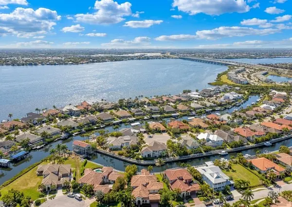
Its location helps explain why waterfront properties on Bird Key, portions of Lido Key, Longboat Key and mainland Sarasota can have different boating routes even when they all ultimately connect with Sarasota Bay.
For homebuyers, proximity to New Pass should not be translated automatically into a promise of convenient Gulf access for every vessel. The route from an individual dock may involve canals, bridges, channels, tides and depth limitations before reaching open bay water or a pass.
Midnight Pass: Why Older Sarasota Guides May Now Be Wrong
Midnight Pass is an important example of why Sarasota coastal information needs a date attached to it. For decades, residents and visitors knew Midnight Pass between Siesta Key and Casey Key as a former Gulf inlet that had been closed since the 1980s.
That description is no longer current.
According to Sarasota County’s current Midnight Pass information, Hurricane Helene reopened an ephemeral inlet in September 2024. Hurricane Milton followed in October 2024 and fully reopened the pass for the first time in more than 40 years.
As of September 2026, Sarasota County reports that Midnight Pass remains open, with observations indicating a functional, sustained tidal inlet system. County staff continue recurring surveys of the inlet and are monitoring its position and cross-sectional area.
Future residents should therefore be cautious with older maps, articles and neighborhood descriptions that simply say Midnight Pass is closed. The current condition is materially different, and monitoring is ongoing.
What Is Little Sarasota Bay?
Little Sarasota Bay lies south of the main Sarasota Bay system behind the southern portion of Siesta Key and Casey Key. It is another protected coastal-water environment connected with the region’s larger network of bays, channels and the Gulf Intracoastal Waterway.
Midnight Pass is particularly relevant to Little Sarasota Bay because the reopened inlet again provides a direct hydrologic connection with the Gulf at that location. Sarasota County is studying how the reopened pass affects water movement and circulation.
For buyers considering south Siesta Key, the mainland east of Little Sarasota Bay or areas farther south toward Casey Key, understanding this geography helps put waterfront descriptions into context.
What Is the Intracoastal Waterway?
When Sarasota boaters talk about the Intracoastal Waterway, they are referring to the protected navigation route running through the bays and waterways behind the barrier islands rather than traveling exclusively in the open Gulf.
For waterfront real estate, access to this broader system can be important. A canal-front home may connect with a larger bay and then the Intracoastal Waterway, while another property may have a different route or restrictions affecting how it can be used.
The phrase "boating access" therefore needs more explanation when evaluating a property. Access for a kayak or shallow-draft skiff does not necessarily establish suitability for a larger powerboat or sailboat.
Why Water Depth Is More Complicated Than It Looks
A waterfront home can have a beautiful dock and still require careful depth research. The water beside the dock is only one part of the route.
A boating buyer may need to evaluate:
- Depth at the dock
- Depth through the canal or residential waterway
- Tidal variation
- Shoaling or sediment accumulation
- Fixed and movable bridge clearances
- Channel location
- The intended vessel’s draft and height
- Dock configuration and lift capacity
- The practical route to Sarasota Bay, the Intracoastal Waterway or Gulf
Hunt Brothers Realty’s Deep-Water Access in Sarasota guide explains why boat owners should evaluate the entire route rather than relying on a general waterfront description.
Which Sarasota Areas Put Buyers Close to the Bay?
Several Sarasota-area residential locations interact directly with Sarasota Bay or waterways leading toward it, but they offer different types of ownership and water access.
Bird Key
Bird Key sits in Sarasota Bay between downtown Sarasota and St. Armands Circle. Buyers can encounter waterfront single-family homes with docks as well as interior residences. For boaters, individual properties still require verification of canal or bay depth, dock characteristics and vessel routes.
Longboat Key
Longboat Key real estate can include Gulf-front condominiums, bayfront residences, boating-oriented properties and communities with different relationships to Sarasota Bay. The island’s elongated geography means north-end and south-end boating routes can differ materially.
Lido Key
Lido Key sits between New Pass and Big Sarasota Pass, with the Gulf on the west and Sarasota Bay waters to the east. Hunt Brothers Realty’s Lido Key living guide provides additional context on the island’s residential and coastal setting.
Siesta Key
Siesta Key combines Gulf beaches with canals and bay-side waters. Big Sarasota Pass defines its northern end, while the reopened Midnight Pass is between southern Siesta Key and Casey Key. Buyers can learn more through Hunt Brothers Realty’s guide to living on Siesta Key.
Harbor Acres
Harbor Acres provides a mainland alternative close to downtown Sarasota. Some waterfront homes connect through canals toward Sarasota Bay, but depth, bridge clearance, dock rights, seawall condition and vessel-specific access should be investigated for each property.
Gulf-Front and Bayfront Are Not the Same Thing
For buyers new to Sarasota, "waterfront" can sound like one category. In practice, the type of water frontage can dramatically change the experience.
A Gulf-front property emphasizes open-water views and direct relationship with the beach and Gulf shoreline. A bayfront property may provide protected-water views and, depending on the property, boating opportunities. Canal frontage can provide dockage and protected access but may involve additional navigation before reaching open bay water.
Hunt Brothers Realty’s guide to Sarasota waterfront areas can help buyers compare the different ways water becomes part of a property search.
What Should New Sarasota Boaters Know Before Heading Out?
Local familiarity develops over time, but new residents should not substitute familiarity for proper navigation and boating-safety practices.
The FWC Boating and Angling Guides include a Sarasota County guide showing main channels, seagrasses, boating speed zones, anchorages, artificial reefs, aquatic preserves, marinas, fishing piers and public boat ramps.
Importantly, FWC states that the educational guide itself should not be used for navigation. Boaters should use appropriate current navigation resources and account for tides, weather, vessel characteristics and actual water conditions.
FWC boating regulations also advise boaters to avoid seagrass beds and stay in channels when unfamiliar with an area.
Do Tides Matter in Sarasota’s Bays and Canals?
Yes. Water level can affect clearance over shallow areas, depth at docks and canals, and the practical use of certain boating routes. The effect will vary by location, weather and other conditions.
This is one reason a buyer should not evaluate a boating property solely during a single showing. A dock that appears to have ample water at one moment does not establish year-round vessel suitability.
FWC recommends consulting tide and navigation information to ensure adequate clearance and avoid shallow waters. Buyers with a specific boat should verify the entire intended route using appropriate current information and qualified marine professionals where needed.
What Should Waterfront Buyers Inspect Beyond the House?
When a Sarasota property includes boating or direct waterfront features, the due-diligence list extends beyond the residence itself.
Depending on the property, buyers may need to evaluate:
- Seawall age, condition and maintenance responsibility
- Dock condition and permitted configuration
- Boat-lift capacity and dimensions
- Depth at the dock and along the route
- Tidal limitations
- Bridge clearances
- Canal width and turning space
- Navigation toward Sarasota Bay and the Gulf
- Riparian and access rights
- Flood information and elevation
- Homeowners and flood insurance
- Permits for docks, seawalls and other waterfront improvements
These are property-specific matters. Seawall, dock and structural conditions should be evaluated by the appropriate qualified inspectors, marine contractors, engineers or other professionals. Navigation, survey, permitting, title and legal questions should be verified through the appropriate current navigation resources, surveyor, governmental authority, title professional or qualified Florida real estate attorney.
What About Flood and Insurance Considerations?
Being near a bay, canal, pass or the Gulf makes property-specific flood and insurance research particularly important. Buyers should review current flood information, available elevation documentation, building characteristics and lender requirements for the individual property.
Insurance considerations can vary significantly between two waterfront properties, even when they appear geographically close. Roof age, construction, elevation, wind mitigation, opening protection, prior claims and condominium association coverage can all be relevant.
Insurance availability, coverage and premiums can vary substantially by property. Buyers should obtain property-specific homeowners and flood insurance information and review coverage with a qualified Florida insurance professional before making a purchasing decision.
A Simple Way to Learn Sarasota’s Water Before Buying
First, Look at the Coast From Land
Visit Lido Key, Siesta Key and Longboat Key. Notice where the Gulf sits relative to Sarasota Bay, where the islands end and where the passes interrupt the coastline.
Second, Explore Sarasota Bay
Experience the bay from an appropriate public location or through a properly operated boat tour or other water-based outing. Notice how quickly the environment changes from deeper channels to shallow flats and seagrass areas.
Third, Match the Water to Your Home Search
Decide whether you actually need a private dock, direct bay frontage, Gulf-front living or simply convenient access to public boating facilities. That decision can substantially change the neighborhoods and property types worth exploring.
Finally, Verify the Exact Property
Once a waterfront property becomes a serious candidate, move from general geography to property-specific due diligence. Verify the dock, seawall, depth, tides, bridges, permits, insurance, flood information and intended boating route rather than assuming that general neighborhood descriptions apply to every home.
Sarasota’s Water Makes More Sense Once You Learn the Map
Sarasota’s waterfront can seem complicated at first because Gulf beaches, bays, canals, channels, sandbars and passes exist close together. The basic geography becomes easier once you understand the role each feature plays.
The Gulf lies outside the barrier islands. Sarasota Bay and Little Sarasota Bay provide protected coastal waters behind them. Passes connect those environments. Channels help define navigation routes through portions of the bays, while sandbars and shallow flats remind boaters that visible water does not necessarily mean deep water.
For future residents, learning that geography can make a waterfront home search much more precise. Instead of simply asking for a house "on the water," you can start asking what kind of water, what route, what depth and what type of everyday coastal experience you actually want.
Explore Sarasota Waterfront Real Estate
Hunt Brothers Realty can help buyers compare Sarasota waterfront properties based on the type of water frontage, boating priorities, island or mainland location and the characteristics of the individual property. Learn more through the Deep-Water Access in Sarasota guide, explore Sarasota waterfront areas, or browse Longboat Key real estate as part of your coastal home search.
This article provides general real estate, geographic, boating and educational information only. It is not individualized navigation, marine, legal, financial, tax, insurance, lending, inspection, engineering, construction, title, flood, permitting or other professional advice. Coastal conditions, depths, channels, shoaling, tides, bridge clearances, docks, seawalls and navigable routes can change and vary by property and vessel. Boaters should use appropriate current navigation resources and follow applicable regulations. Buyers should verify property-specific conditions with the appropriate licensed real estate professional, insurance agent, lender, home inspector, marine contractor, structural engineer, surveyor, title or closing professional, governmental authority, qualified Florida real estate attorney or other appropriate professional before making a decision that depends on individualized information.
Sources
- Sarasota County, Midnight Pass Current Status, Monitoring and History
- Sarasota Bay Estuary Program
- Florida Fish and Wildlife Conservation Commission, Boating and Angling Guides
- Florida Fish and Wildlife Conservation Commission, Boating Regulations and Seagrass Awareness
- Florida Fish and Wildlife Conservation Commission, Marine Habitats and Seagrass
- Florida Fish and Wildlife Conservation Commission, Boating Conservation Guidance
- Florida Fish and Wildlife Conservation Commission, Waterway Markers
- Hunt Brothers Realty, Deep-Water Access in Sarasota: A Guide for Boat Owners
- Hunt Brothers Realty, Best Sarasota Areas for Waterfront Living
- Hunt Brothers Realty, Living on Siesta Key: What Home Buyers Should Know
- Hunt Brothers Realty, Lido Key Living: Beaches, Homes and Lifestyle
- Hunt Brothers Realty, Longboat Key Real Estate
Contact Hunt Brothers Realty
46 N. Washington Blvd, Ste 3, Sarasota, FL 34236
Phone: (941) 388-7017
Email: info@huntbrothersrealty.com
Website: HuntBrothersRealty.com
Categories
- All Blogs 1626
- Anna Maria Island 77
- Bird Key 3
- Bradenton 155
- Buying a Home 759
- Casey Key 2
- Clearwater 5
- Condos & HOA Living 667
- Ellenton 4
- Englewood 5
- First Time Homebuyers 840
- Foreclosures 3
- Homeownership 829
- Lakewood Ranch 15
- Lido Key 25
- Longboat Key 74
- Luxury/Waterfront Properties 766
- Market Updates & Trends 402
- Mortgages & Financing 34
- Move-Up Buyers 20
- Neighborhood Guides 550
- New Construction 27
- Palmetto 2
- Parrish 4
- Port Charlotte 7
- Punta Gorda 11
- Real Estate Investing 698
- Relocation to Florida 749
- Safety Harbor 2
- Sarasota 24
- Sarasota - Downtown 141
- Selling a Home 138
- Siesta Key 87
- St. Petersburg 3
- Tierra Verde 4
- Vacation & Second Homes 879
- Venice 21
- Wellen Park 7
Recent Posts